2024 Wisconsin Voting Maps
Find your new State Senate & Assembly Districts
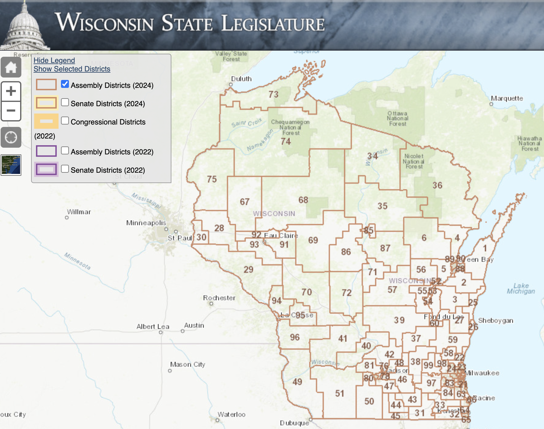
Wisconsin Legislative Technology Services Bureau
Download Data of the 2023 Wisconsin Act 94 legislative districts are now available.

AUTHOR John Johnson
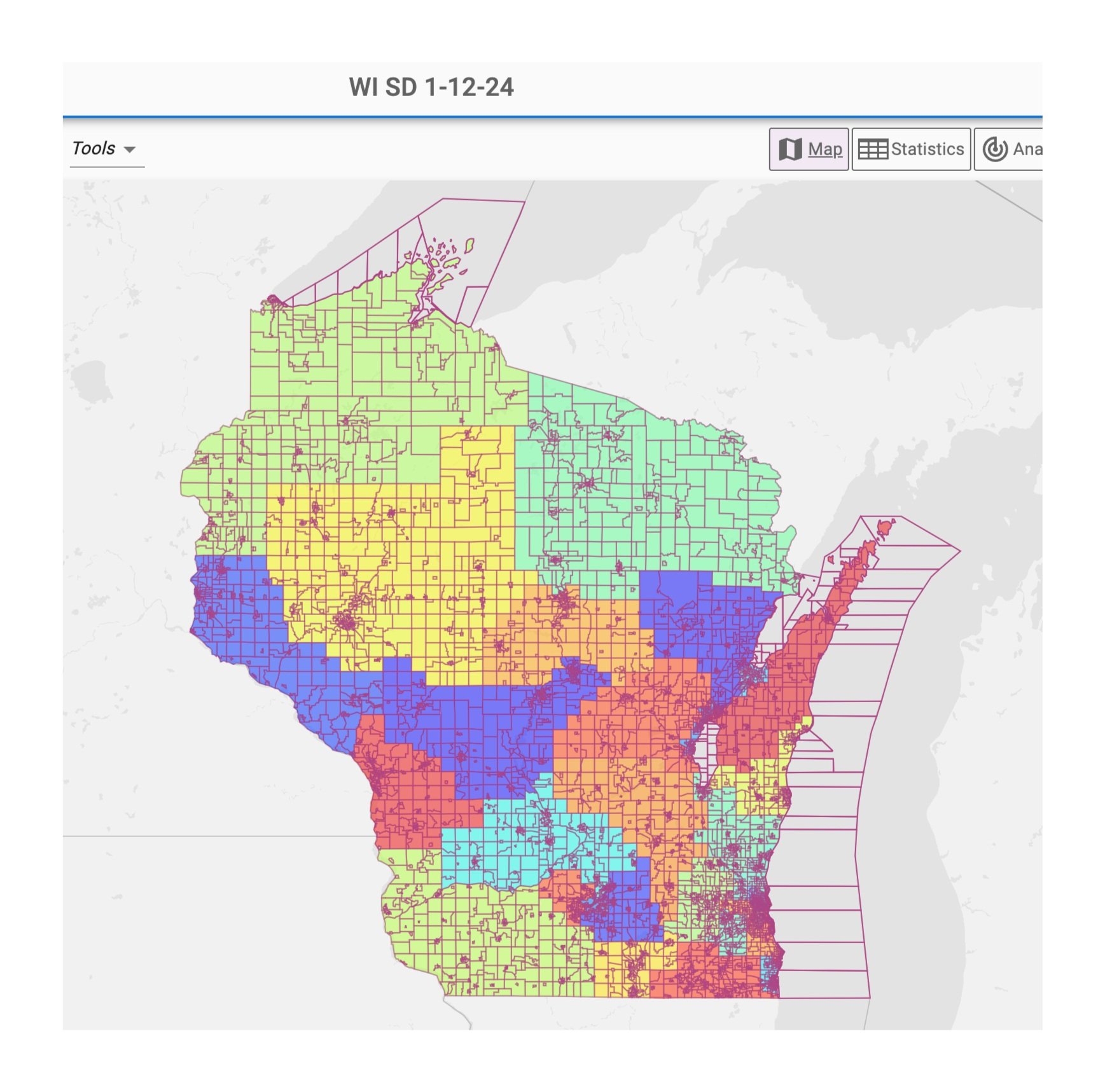
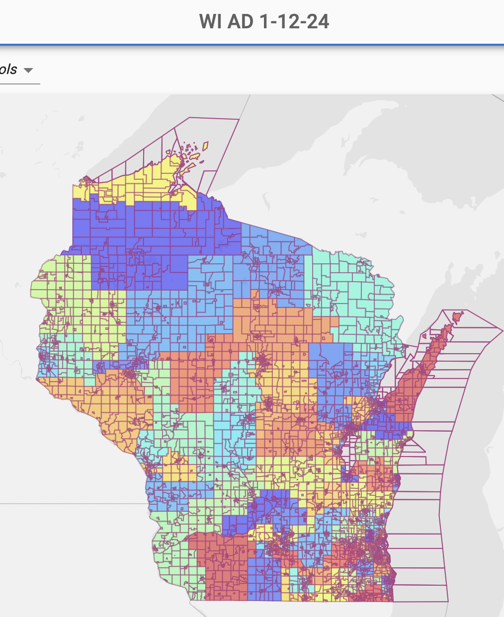
The following interactive web maps show the borders of the maps originally submitted the Wisconsin Supreme Court by Gov. Evers in Jan. 2024 and the old districts used during the 2022 state legislative election.
Click on a district to see the name and the modeled Republican or Democratic vote share in the 2022 election. For details about this analysis, please see the Marquette Law School Faculty Blog.

According to the Milwaukee Journal Sentinel, the analysis of the districts reflected on these interactive maps is derived from precinct-level voting data calculated by Dave’s Redistricting App based on national and local elections from 2016 to 2022. These maps allow you to compare 2022 maps with 2024 maps for state senate and assembly.
Dave’s Redistricting App Maps
These resources allow you to view voting district maps and analyze them based on various demographic information including competitiveness, proportionality, minority representation, compactness and more.
Senate District Map Assembly District Map